Travel Guide of Kula in United States by Influencers and Travelers
Kula is a district of Maui, Hawaii, that stretches across the "up-country", the western-facing slopes of Haleakalā, from Makawao to Kanaio. Most of the residential areas lie between about 500 to 1,100 m in elevation.
The Best Things to Do and Visit in Kula
TRAVELERS TOP 10 :
1 - Maui County
Lahaina is the largest census-designated place in West Maui, Maui County, Hawaii, United States and includes the Kaanapali and Kapalua beach resorts. As of the 2010 census, the CDP had a resident population of 11,704.
Learn more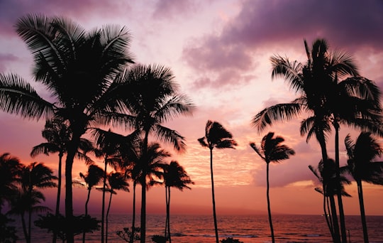
2 - Haleakalā Observatory
12 km away
The Haleakalā Observatory, also known as the Haleakalā High Altitude Observatory Site, is Hawaii's first astronomical research observatory.
View on Google Maps Book this experience
3 - Snorkelling in Maui
19 km away
Discover the gems of Hawaii and its bountiful underwater world on this 3-hour family-friendly excursion, snorkelling in Maui from Maalaea! Welcoming beginners and aquatic explorers of all ages. Located in the pristine waters of the central Pacific Oc...
Book this experience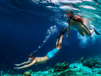
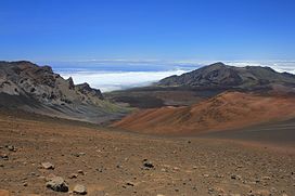
4 - Haleakalā
12 km away
Haleakalā, or the East Maui Volcano, is a massive shield volcano that forms more than 75% of the Hawaiian Island of Maui. The western 25% of the island is formed by another volcano, Mauna Kahalawai, also referred to as the West Maui Mountains.
Learn more Book this experience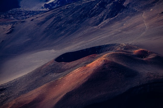
5 - Paia
13 km away
Pā'ia is a census-designated place in Maui County, Hawaii, United States, on the northern coast of the island of Maui. The population was 2,470 at the 2020 census.
Learn more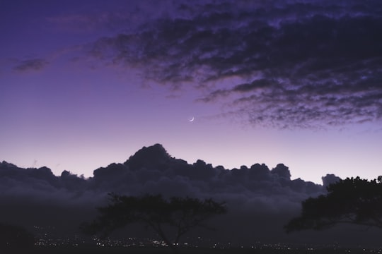
6 - Bike Tours in Maui
14 km away
Bike down Maui’s Haleakala Volcano and enjoy the freedom of exploring this wild and breathtaking landscape at your own unique rhythm!Biking an open road is an absolutely liberating sensation, and when that road is made up of 29 switchbacks going do...
Book this experience
7 - Alexander & Baldwin Sugar Museum
14 km away
Alexander & Baldwin Sugar Museum is located in the small sugarcane growing and milling community of Puʻunene, Hawaii, Kahului, Maui.
View on Google Maps Book this experience
8 - Haiku
14 km away
Haiku is an unincorporated community in Maui County on the island of Maui in the state of Hawaii. For United States Census purposes, it is part of the Haiku-Pauwela census-designated place, which also includes Pauwela.
Learn more
9 - Dolphin & Whale Watching | Kihei
Embark on a boat tour of turtle town in Maui's only glass bottom kayaks and witness the variety of diverse marine life.
Book this experience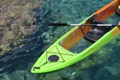
10 - Peahi
15 km away
Peʻahi is a place on the north shore of the island of Maui in the U.S. state of Hawaii. It has lent its name to a big wave surfing break, also known as Jaws.
View on Google Maps Book this experience
11 - Ho‘okipa
16 km away
Hoʻokipa is a beach on the north shore of Maui, Hawaii, United States, perhaps the most renowned windsurfing site in the world.
View on Google Maps Book this experience
12 - Snorkeling | Maui
Enjoy a leisurely morning before embarking on a thrilling raft boat cruise to Molokini Crater. Keep an eye out for majestic whales from December 15 to April 30, and go snorkeling in the clear water.
Book this experience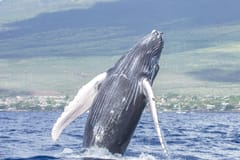
13 - Hana Highway
16 km away
The Hana Highway is a 64.4-mile-long stretch of Hawaii Routes 36 and 360 which connects Kahului to the town of Hana in east Maui. To the east of Kalepa Bridge, the highway continues to Kipahulu as Hawaii Route 31.
Learn more Book this experience

14 - Wailea
16 km away
Wailea is a census-designated place in Maui County, Hawaii, United States. As of the 2010 census, it had a population of 5,938. Prior to 2010, the area was part of the Wailea-Makena census-designated place. The community was developed in 1971 by a partnership of Alexander & Baldwin and Northwestern Mutual.
View on Google Maps Book this experience
15 - Paragliding in Maui
6 km away
Maui is the second most visited Hawaiian island for good reason – with some of the best beaches, snorkelling spots, and an incredible diversity of landscapes from mountain to rainforest, Maui is a must see when visiting Hawaii! While there is certa...
Book this experience
16 - Haleakalā National Park
19 km away
Haleakalā National Park is an American national park located on the island of Maui in the state of Hawaii. Named after Haleakalā, a dormant volcano within its boundaries, the park covers an area of 33,265 acres, of which 24,719 acres is a wilderness area.
Learn more Book this experience

Disover the best Instagram Spots around Kula here
Book Tours and Activities in Kula
Discover the best tours and activities around Kula, United States and book your travel experience today with our booking partners
Pictures and Stories of Kula from Influencers
2 pictures of Kula from Anton Repponen, Alex Wolfe, and other travelers
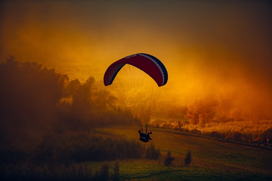
- Paraglider in orange clouds ...click to read more
- Experienced by @Anton Repponen | ©Unsplash
Plan your trip in Kula with AI 🤖 🗺
Roadtrips.ai is a AI powered trip planner that you can use to generate a customized trip itinerary for any destination in United States in just one clickJust write your activities preferences, budget and number of days travelling and our artificial intelligence will do the rest for you
👉 Use the AI Trip Planner
Why should you visit Kula ?
Travel to Kula if you like:
⛰️ HillWhere to Stay in Kula
Discover the best hotels around Kula, United States and book your stay today with our booking partner booking.com
More Travel spots to explore around Kula
Click on the pictures to learn more about the places and to get directions
Discover more travel spots to explore around Kula
️🏜️ Desert spots ⛰️ Hill spots ⛰️ Mountain spots Paragliding spotsTravel map of Kula
Explore popular touristic places around Kula